 Clarksville, TN – The Cumberland River has crested at Clarksville at 47.65ft at 10:30pm on April 28th 2012. This is the 10 highest flood on record passing the 47.40 ft record set February 17th 2003. At 46 feet, the left bank of the Cumberland River overflows and flooding officially begins in Clarksville. For comparison purposes the May 2010 floods crested at 62.58 ft.
McGregor Park is closed with most of the walkways and all of the Plaza’s underwater. Clarksville Department of Parks and Recreation maintenance employees had already removed their equipment from their storerooms beneath the River Center the previous day as a precaution. Early this morning workers were on hand monitoring the river levels and attempting to keep the flood debris from settling in the stairwells
Liberty Park is also closed due to water blocking the roads leading to the Clarksville Marina. Parks and Recreation had workers on hand to turn away the curious.
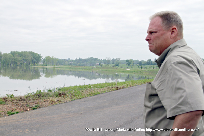
I ran into Mark Tummons the Director of the Clarksville Department of Parks and Recreation as he surveyed the flooded Liberty Park. He felt that this flood was similar to level the Cumberland River reached in the Spring of 2011. He pointed out that with the exception of the Bark Park’s pavilion, all of the buildings were high and dry above the water level. “Once the water levels recede, we will enter cleanup mode. Once the cleanup is complete we will re-open the parks to the public as quickly as possible.”


Leaving Liberty Park I headed over to Dunbar Cave Road to get a few photos of the flooding over there. At Dunbar Cave State Natural Area Swan Lake crested it’s banks at several points not just the spillway. Dunbar Cave Road was underwater as we had previously reported. Idaho Springs Road and Acuff Roads were both underwater as well.
According to the National Weather Service, the flood warning continues for the following rivers in Tennessee; the Cumberland River at Clarksville affecting Montgomery County, the Red River at Port Royal affecting Montgomery and Robertson Counties. Runoff from recent heavy rainfall continues to move through rivers across Middle Tennessee.
Both the Red River and the Cumberland River have crested and are subsiding, the rivers will continue to fall and is expected to be below flood stage by this evening. As such the flood warning has been extended until April 30th at 2:18am.
Photo Gallery