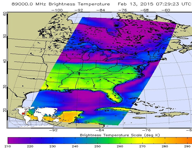
This false-colored infrared image from the AIRS instrument aboard NASA’s Aqua satellite at 7:29 UTC (2:29 a.m. EST) shows cloud top temperatures over New York, Vermont, and New Hampshire near 245K/-28C/-18F (greenish to blue shading). (NASA JPL, Ed Olsen)
Home This false-colored infrared image from the AIRS instrument aboard NASA’s Aqua satellite at 7:29 UTC (2:29 a.m. EST) shows cloud top temperatures over New York, Vermont, and New Hampshire near 245K/-28C/-18F (greenish to blue shading). (NASA JPL, Ed Olsen) This false-colored infrared image from the AIRS instrument aboard NASA's Aqua satellite at 7:29 UTC (2:29 a.m. EST) shows cloud top temperatures over New York, Vermont, and New Hampshire near 245K/-28C/-18F (greenish to blue shading). (NASA JPL, Ed Olsen)
This false-colored infrared image from the AIRS instrument aboard NASA’s Aqua satellite at 7:29 UTC (2:29 a.m. EST) shows cloud top temperatures over New York, Vermont, and New Hampshire near 245K/-28C/-18F (greenish to blue shading). (NASA JPL, Ed Olsen)