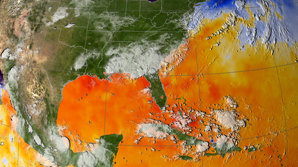
This map of ocean surface temperatures shows how warm waters in the North Atlantic fueled Hurricane Katrina. NASA and UCI researchers have found that the same conditions heighten fire risk in the Amazon basin. (Scientific Visualization Studio, NASA’s Goddard Space Flight Center)
Home This map of ocean surface temperatures shows how warm waters in the North Atlantic fueled Hurricane Katrina. NASA and UCI researchers have found that the same conditions heighten fire risk in the Amazon basin. (Scientific Visualization Studio, NASA’s Goddard Space Flight Center) This map of ocean surface temperatures shows how warm waters in the North Atlantic fueled Hurricane Katrina. NASA and UCI researchers have found that the same conditions heighten fire risk in the Amazon basin. (Scientific Visualization Studio, NASA’s Goddard Space Flight Center)
This map of ocean surface temperatures shows how warm waters in the North Atlantic fueled Hurricane Katrina. NASA and UCI researchers have found that the same conditions heighten fire risk in the Amazon basin. (Scientific Visualization Studio, NASA’s Goddard Space Flight Center)