Written by Darryl Waller
NASA Ames Research Center
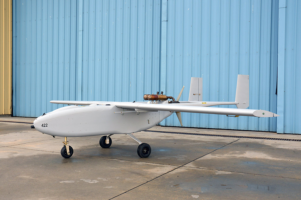
 Moffett Field, CA – NASA has delivered an unmanned aircraft system (UAS) to the University of Kansas in Lawrence for student training and development of a radar system for analyzing glaciers in Greenland associated with sea-level rise around the globe.
The UAS, named Viking-400, will allow students and faculty in the university’s Department of Aeronautical Engineering to gain hands-on experience with a production air vehicle to complement the school’s curriculum. . It will also facilitate the integration of radar instrument onto the aircraft. Students also will generate 3-D models of the aircraft that NASA will use for engineering and analysis.

NASA’s Cryospheric Sciences Program seeks to understand the connections between the polar ice sheets and the global Earth system. In the polar regions, the program relies heavily on manned aircraft such as those used to support the multi-year Operation IceBridge mission. These aircraft have operational windows that are limited by poor weather, runway accessibility, and the polar night.
Unmanned systems have the potential to provide more frequent and higher resolution measurements to complement these measurements as well as those satellites such as the ICESat-2 satellite, planned for launch in 2018.
The Viking UAS has a maximum range of 600 nautical miles and endurance of 11 hours, and is designed for data collection missions in remote or dangerous environments. It is large enough to carry up to 100 pounds of scientific instruments for up to 600 miles, yet small enough not to require a large runway or hangar. Ames currently manages eight Viking systems.
“We’re always looking for ways to more efficiently collect data in the polar regions,” said Thomas Wagner, NASA’s program scientist for the cryosphere at NASA Headquarters in Washington. “And UAS may have the potential to not just reduce, but also reduce our environmental impact while potentially allowing us to collect data we cannot otherwise obtain.”
KU students will develop and integrate several high-tech radars, including a High Frequency (HF) sounder, Very High Frequency (VHF) multi-channel coherent radar depth sounder/imager, and an ultra-wideband (UWB) microwave radar, referred to as the snow radar.
The HF and VHF measure ice thickness, and the UWB microwave radar can take centimeter-scale fine resolution measurements of snow thickness while mapping internal layers in the snow. The data will be used to improve projections of the land ice contributions to sea level rise while improving our understanding of the connections between sea ice change and global climate.
In addition to the short-term goals of meeting immediate science needs and expanding the fleet of available platforms for cryospheric research, Ames’ longer-term vision is to demonstrate the scientific utility of UAS integrated with radars for polar research. Scientists worldwide use NASA data to tackle some of the biggest questions about how our planet is changing now and how Earth could change in the future.
From rising sea levels to the changing availability of freshwater, NASA enables studies that unravel the complexities of our planet from the highest reaches of Earth’s atmosphere to its core.


