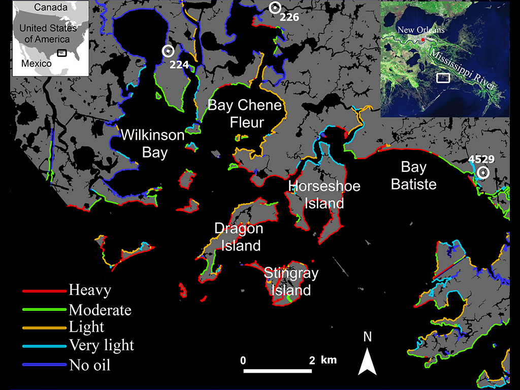
Map of Northeastern Barataria Bay, Louisiana, showing shores oiled by the Deepwater Horizon oil spill during May to July 2010. The severity of oiling is indicated by the colors. The information is derived from a 2014 NOAA Shoreline Cleanup Assessment Techniques (SCAT) map. (USGS/NOAA/NASA-JPL/Caltech)
Home Map of Northeastern Barataria Bay, Louisiana, showing shores oiled by the Deepwater Horizon oil spill during May to July 2010. The severity of oiling is indicated by the colors. The information is derived from a 2014 NOAA Shoreline Cleanup Assessment Techniques (SCAT) map. (USGS/NOAA/NASA-JPL/Caltech) Map of Northeastern Barataria Bay, Louisiana, showing shores oiled by the Deepwater Horizon oil spill during May to July 2010. The severity of oiling is indicated by the colors. The information is derived from a 2014 NOAA Shoreline Cleanup Assessment Techniques (SCAT) map. (USGS/NOAA/NASA-JPL/Caltech)
Map of Northeastern Barataria Bay, Louisiana, showing shores oiled by the Deepwater Horizon oil spill during May to July 2010. The severity of oiling is indicated by the colors. The information is derived from a 2014 NOAA Shoreline Cleanup Assessment Techniques (SCAT) map. (USGS/NOAA/NASA-JPL/Caltech)