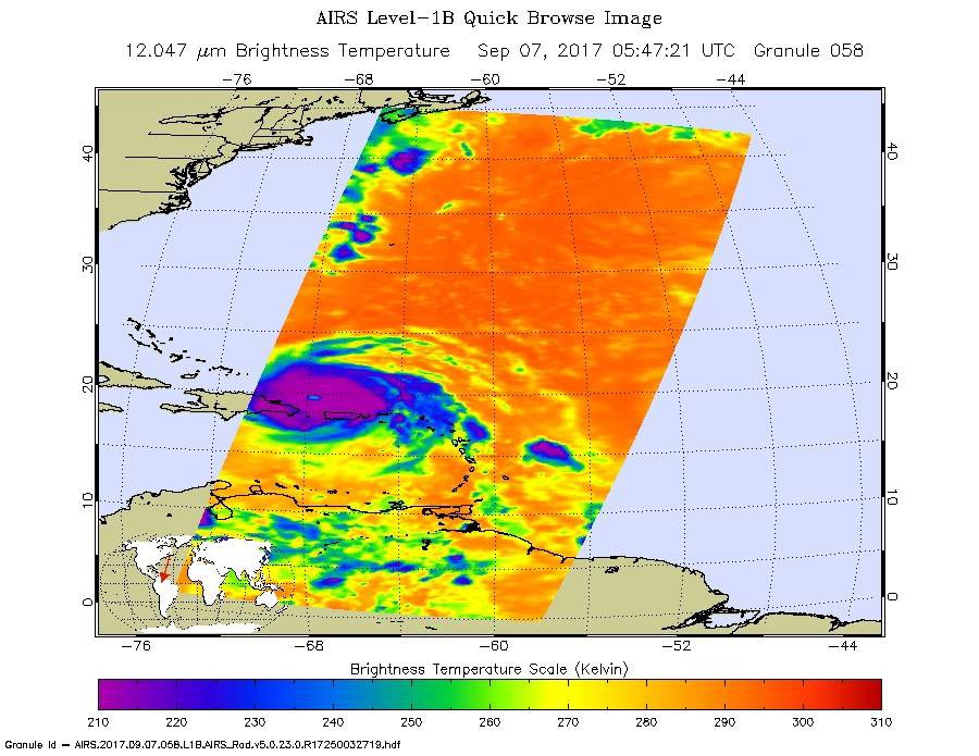
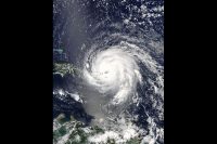
NASA’s Aqua satellite captured infrared temperature data on Hurricane Irma on Sept. 7 at 1:47 a.m. EDT (0547 UTC). The image showed a clear eye and very cold cloud top temperatures as cold as minus 63 degrees Fahrenheit (minus 53 degrees Celsius). The southwestern quadrant of the storm was over Puerto Rico. (NASA JPL/Ed Olsen)
Home NASA’s Aqua satellite captured infrared temperature data on Hurricane Irma on Sept. 7 at 1:47 a.m. EDT (0547 UTC). The image showed a clear eye and very cold cloud top temperatures as cold as minus 63 degrees Fahrenheit (minus 53 degrees Celsius). The southwestern quadrant of the storm was over Puerto Rico. (NASA JPL/Ed Olsen) NASA's Aqua satellite captured infrared temperature data on Hurricane Irma on Sept. 7 at 1:47 a.m. EDT (0547 UTC). The image showed a clear eye and very cold cloud top temperatures as cold as minus 63 degrees Fahrenheit (minus 53 degrees Celsius). The southwestern quadrant of the storm was over Puerto Rico. (NASA JPL/Ed Olsen)
NASA’s Aqua satellite captured infrared temperature data on Hurricane Irma on Sept. 7 at 1:47 a.m. EDT (0547 UTC). The image showed a clear eye and very cold cloud top temperatures as cold as minus 63 degrees Fahrenheit (minus 53 degrees Celsius). The southwestern quadrant of the storm was over Puerto Rico. (NASA JPL/Ed Olsen)