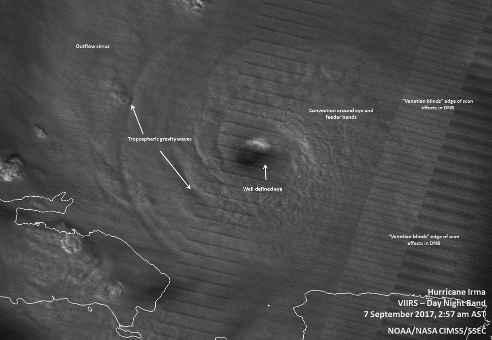
At 2:57 a.m. AST/EDT on Sept. 7, Suomi NPP’s Day Night Band imagery and the waning gibbous moon highlighted the convection around Irma’s eye and tropospheric gravity waves were present around the well-defined eyewall. (NOAA/NASA/UWM-CIMSS, William Straka III)
Home At 2:57 a.m. AST/EDT on Sept. 7, Suomi NPP’s Day Night Band imagery and the waning gibbous moon highlighted the convection around Irma’s eye and tropospheric gravity waves were present around the well-defined eyewall. (NOAA/NASA/UWM-CIMSS, William Straka III) At 2:57 a.m. AST/EDT on Sept. 7, Suomi NPP's Day Night Band imagery and the waning gibbous moon highlighted the convection around Irma's eye and tropospheric gravity waves were present around the well-defined eyewall. (NOAA/NASA/UWM-CIMSS, William Straka III)
At 2:57 a.m. AST/EDT on Sept. 7, Suomi NPP’s Day Night Band imagery and the waning gibbous moon highlighted the convection around Irma’s eye and tropospheric gravity waves were present around the well-defined eyewall. (NOAA/NASA/UWM-CIMSS, William Straka III)