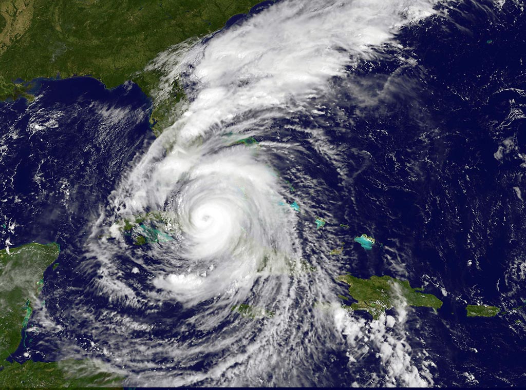
This visible image of Category 4 Hurricane Irma was taken on Saturday, September 9, 2017 at 10:37 a.m. EDT (1437 UTC) by the NOAA GOES East satellite. (NASA/NOAA GOES Project)
Home This visible image of Category 4 Hurricane Irma was taken on Saturday, September 9, 2017 at 10:37 a.m. EDT (1437 UTC) by the NOAA GOES East satellite. (NASA/NOAA GOES Project) This visible image of Category 4 Hurricane Irma was taken on Saturday, September 9, 2017 at 10:37 a.m. EDT (1437 UTC) by the NOAA GOES East satellite. (NASA/NOAA GOES Project)
This visible image of Category 4 Hurricane Irma was taken on Saturday, September 9, 2017 at 10:37 a.m. EDT (1437 UTC) by the NOAA GOES East satellite. (NASA/NOAA GOES Project)