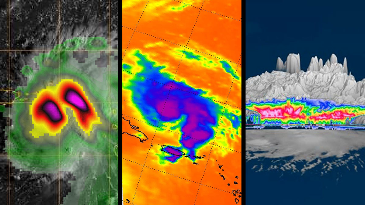
Three images of Hurricane Dorian, as seen by a trio of NASA’s Earth-observing satellites Aug. 27-29, 2019. The data sent by the spacecraft revealed in-depth views of the storm, including detailed heavy rain, cloud height and wind. (NASA/JPL-Caltech)
Home Three images of Hurricane Dorian, as seen by a trio of NASA’s Earth-observing satellites Aug. 27-29, 2019. The data sent by the spacecraft revealed in-depth views of the storm, including detailed heavy rain, cloud height and wind. (NASA/JPL-Caltech) Three images of Hurricane Dorian, as seen by a trio of NASA's Earth-observing satellites Aug. 27-29, 2019. The data sent by the spacecraft revealed in-depth views of the storm, including detailed heavy rain, cloud height and wind. (NASA/JPL-Caltech)
Three images of Hurricane Dorian, as seen by a trio of NASA’s Earth-observing satellites Aug. 27-29, 2019. The data sent by the spacecraft revealed in-depth views of the storm, including detailed heavy rain, cloud height and wind. (NASA/JPL-Caltech)