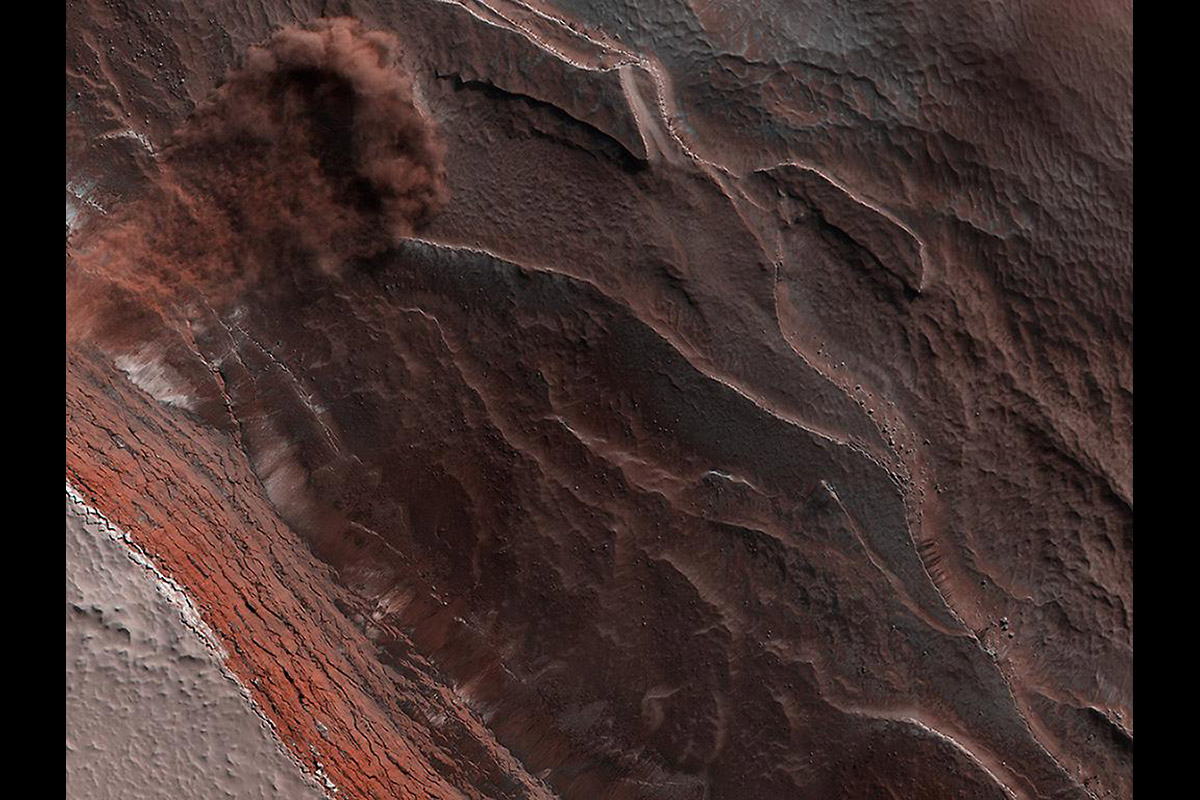
The High-Resolution Imaging Science Experiment (Hi-RISE) camera aboard NASA’s Mars Reconnaissance Orbiter captured this avalanche plunging down a 1,640-foot-tall (500-meter-tall) cliff on May 29, 2019. The image also reveals layers at Mars’ north pole during spring. As temperatures increase and vaporize ice, the destabilized ice blocks break loose and kick up dust. (NASA/JPL-Caltech/University of Arizona)
Home The High-Resolution Imaging Science Experiment (Hi-RISE) camera aboard NASA’s Mars Reconnaissance Orbiter captured this avalanche plunging down a 1,640-foot-tall (500-meter-tall) cliff on May 29, 2019. The image also reveals layers at Mars’ north pole during spring. As temperatures increase and vaporize ice, the destabilized ice blocks break loose and kick up dust. (NASA/JPL-Caltech/University of Arizona) The High-Resolution Imaging Science Experiment (Hi-RISE) camera aboard NASA's Mars Reconnaissance Orbiter captured this avalanche plunging down a 1,640-foot-tall (500-meter-tall) cliff on May 29, 2019. The image also reveals layers at Mars' north pole during spring. As temperatures increase and vaporize ice, the destabilized ice blocks break loose and kick up dust. (NASA/JPL-Caltech/University of Arizona)
The High-Resolution Imaging Science Experiment (Hi-RISE) camera aboard NASA’s Mars Reconnaissance Orbiter captured this avalanche plunging down a 1,640-foot-tall (500-meter-tall) cliff on May 29, 2019. The image also reveals layers at Mars’ north pole during spring. As temperatures increase and vaporize ice, the destabilized ice blocks break loose and kick up dust. (NASA/JPL-Caltech/University of Arizona)