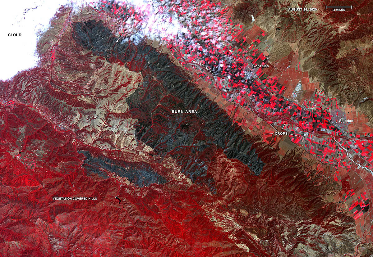
Captured by the ASTER instrument aboard NASA’s Terra satellite, this false-color map shows the burn area of the River and Carmel fires in Monterey County, California. Vegetation (including crops) is shown in red; the burn area (dark blue/gray) is in the center of the image. (NASA/METI/AIST/Japan Space Systems)
Home Captured by the ASTER instrument aboard NASA’s Terra satellite, this false-color map shows the burn area of the River and Carmel fires in Monterey County, California. Vegetation (including crops) is shown in red; the burn area (dark blue/gray) is in the center of the image. (NASA/METI/AIST/Japan Space Systems) Captured by the ASTER instrument aboard NASA's Terra satellite, this false-color map shows the burn area of the River and Carmel fires in Monterey County, California. Vegetation (including crops) is shown in red; the burn area (dark blue/gray) is in the center of the image. (NASA/METI/AIST/Japan Space Systems)
Captured by the ASTER instrument aboard NASA’s Terra satellite, this false-color map shows the burn area of the River and Carmel fires in Monterey County, California. Vegetation (including crops) is shown in red; the burn area (dark blue/gray) is in the center of the image. (NASA/METI/AIST/Japan Space Systems)