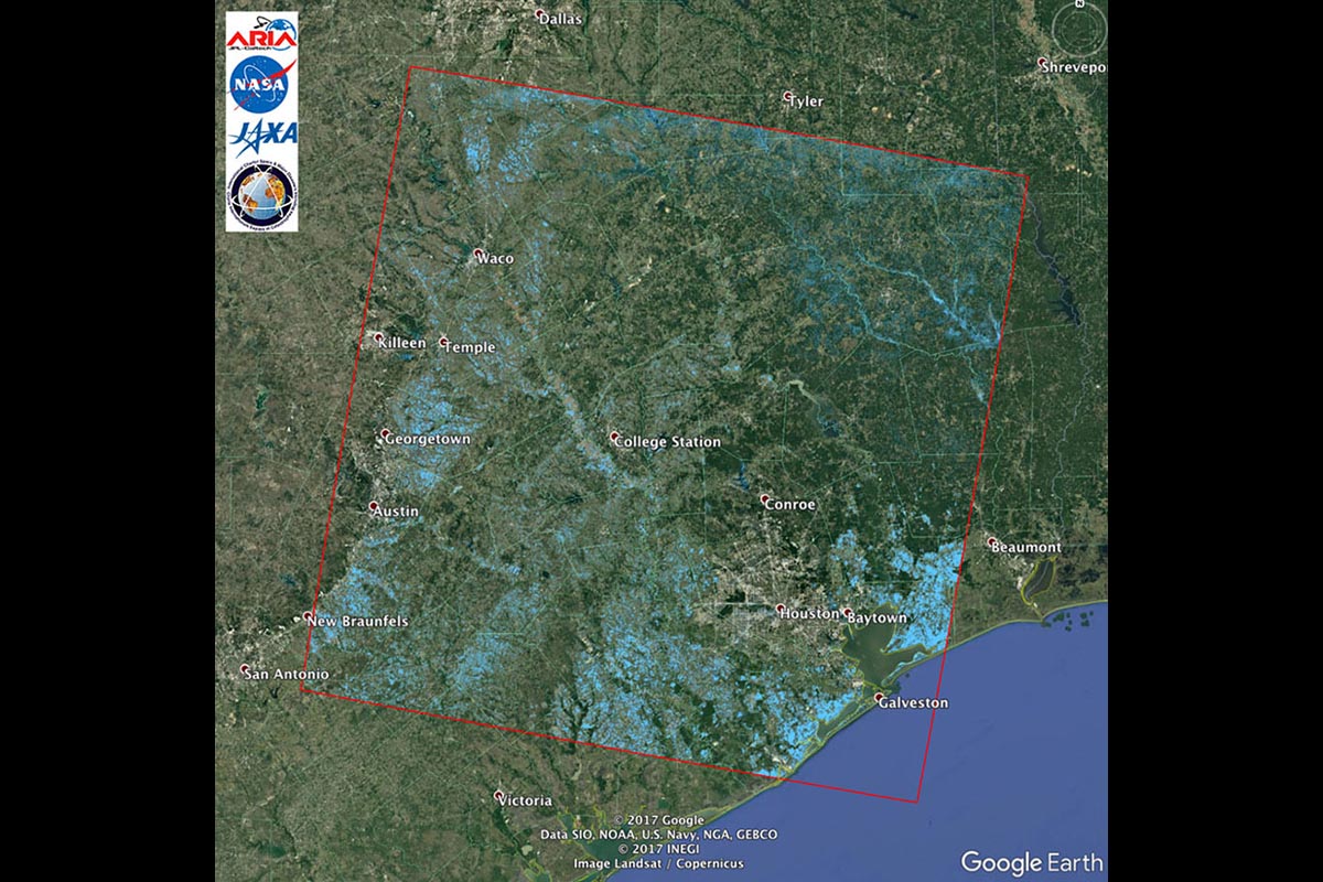
JPL’s Advanced Rapid Imaging and Analysis team created this Flood Proxy Map showing areas of Southeast Texas likely flooded from Hurricane Harvey (light blue). The map is derived from radar images from the Japan Aerospace Exploration Agency ALOS-2 PALSAR-2 satellite before and after landfall. (NASA/JPL-Caltech/JAXA/METI/Google Earth)
Home JPL’s Advanced Rapid Imaging and Analysis team created this Flood Proxy Map showing areas of Southeast Texas likely flooded from Hurricane Harvey (light blue). The map is derived from radar images from the Japan Aerospace Exploration Agency ALOS-2 PALSAR-2 satellite before and after landfall. (NASA/JPL-Caltech/JAXA/METI/Google Earth) JPL's Advanced Rapid Imaging and Analysis team created this Flood Proxy Map showing areas of Southeast Texas likely flooded from Hurricane Harvey (light blue). The map is derived from radar images from the Japan Aerospace Exploration Agency ALOS-2 PALSAR-2 satellite before and after landfall. (NASA/JPL-Caltech/JAXA/METI/Google Earth)
JPL’s Advanced Rapid Imaging and Analysis team created this Flood Proxy Map showing areas of Southeast Texas likely flooded from Hurricane Harvey (light blue). The map is derived from radar images from the Japan Aerospace Exploration Agency ALOS-2 PALSAR-2 satellite before and after landfall. (NASA/JPL-Caltech/JAXA/METI/Google Earth)


