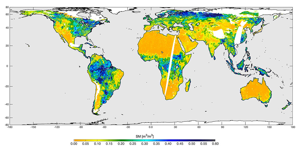
High-resolution global soil moisture map from SMAP’s combined radar and radiometer instruments, acquired between May 4 and May 11, 2015 during SMAP’s commissioning phase. The map has a resolution of 5.6 miles (9 kilometers). The data gap is due to turning the instruments on and off during testing. (NASA/JPL-Caltech/GSFC)
Home High-resolution global soil moisture map from SMAP’s combined radar and radiometer instruments, acquired between May 4 and May 11, 2015 during SMAP’s commissioning phase. The map has a resolution of 5.6 miles (9 kilometers). The data gap is due to turning the instruments on and off during testing. (NASA/JPL-Caltech/GSFC) High-resolution global soil moisture map from SMAP's combined radar and radiometer instruments, acquired between May 4 and May 11, 2015 during SMAP's commissioning phase. The map has a resolution of 5.6 miles (9 kilometers). The data gap is due to turning the instruments on and off during testing. (NASA/JPL-Caltech/GSFC)
High-resolution global soil moisture map from SMAP’s combined radar and radiometer instruments, acquired between May 4 and May 11, 2015 during SMAP’s commissioning phase. The map has a resolution of 5.6 miles (9 kilometers). The data gap is due to turning the instruments on and off during testing. (NASA/JPL-Caltech/GSFC)