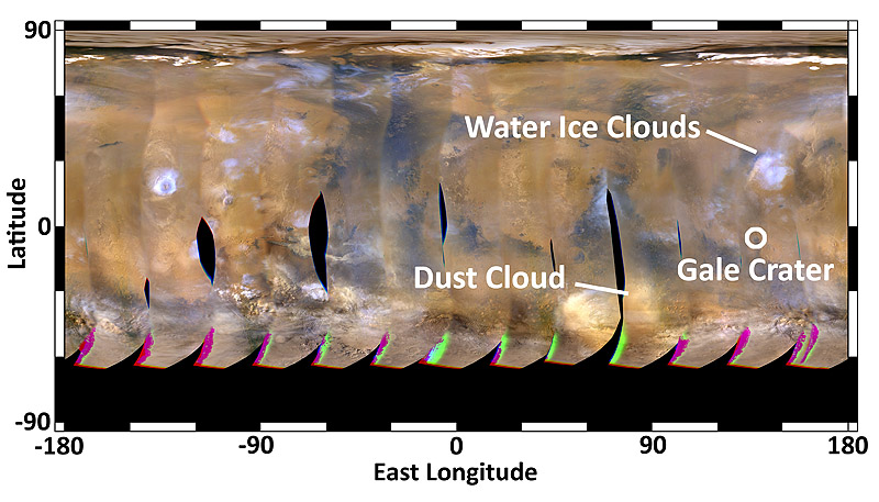
Home This global map of Mars was acquired on August 2nd, 2012, by the Mars Color Imager instrument on NASA’s Mars Reconnaissance Orbiter. One global map is generated each day to forecast weather conditions for the entry, descent and landing of NASA’s Curiosity rover. The active dust storm observed south of Curiosity’s landing site on July 31st has dissipated, leaving behind a dust cloud that will not pose a threat to the landing. (Image credit: NASA/JPL-Caltech/MSSS) This global map of Mars was acquired on August 2nd, 2012, by the Mars Color Imager instrument on NASA's Mars Reconnaissance Orbiter. One global map is generated each day to forecast weather conditions for the entry, descent and landing of NASA's Curiosity rover. The active dust storm observed south of Curiosity's landing site on July 31st has dissipated, leaving behind a dust cloud that will not pose a threat to the landing. (Image credit: NASA/JPL-Caltech/MSSS)
This global map of Mars was acquired on August 2nd, 2012, by the Mars Color Imager instrument on NASA’s Mars Reconnaissance Orbiter. One global map is generated each day to forecast weather conditions for the entry, descent and landing of NASA’s Curiosity rover. The active dust storm observed south of Curiosity’s landing site on July 31st has dissipated, leaving behind a dust cloud that will not pose a threat to the landing. (Image credit: NASA/JPL-Caltech/MSSS)