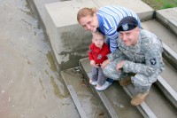
Tim and Ana introducing their 15 month old son Johnny to the rising river.
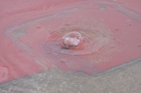
Water bubbles out the top of the terrace as the rising river gets ever closer to flooding it.
The water is less than one inch from the top of the terrace
The river starts flooding over the top of the terrace
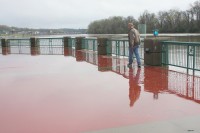
Mark Haynes walks along the top of the water covered terrace.
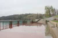
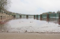
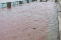
The south end of the flooded terrace looking north.
From the north end looking south. The water is less than 2 inches at this point
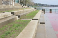
These are the steps and will let you compare the later shots of the terrace.
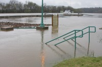
The steps looking towards the north ramp.
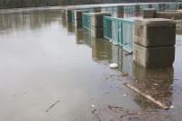
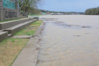
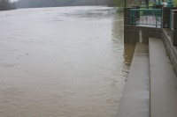
The upstream side of the terrace
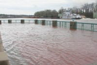
The towboat Evey-T passing by the submerged terrace.
3-4 inches and getting deeper
Waves created by the passing towboat crosses the terrace as the water reaches the bottom of the guard rails
Tim and Ana show their 15 month old son Johnny the rising river at the McGregor park terrace.
As the pond at the fairgrounds overflows, a Great Blue Heron takes the opportunity to snap up passing minnows
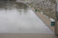
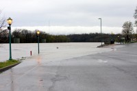
The McGregor Park boat ramp.
The water has risen at least two feet since our last picture of this approximately 8 hours before.
The water has risen at least two feet since our last picture of this approximately 8 hours before.
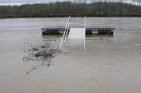
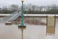
A view from the ramp looking south. The Terrace is completely gone including the guard rails.
The fairground boat dock again floating high enough to submerge the access ramps
The water is reaching the pavilion at the fairgrounds boat ramp. One of the boat docks can be seen out in the river.
Looking across the lake where the fair is held to the rodeo pavilion
Two steps submerged almost to the top of the last one. This means the river is up at least 5 feet over the top of the terrace.
Just six inches to the top
Looking north towards the ramp
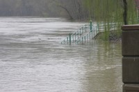
Looking south from the north side of the terrace
The new McGregor Park courtesy boat dock
A boat tied to the courtesy boat dock is totally inaccessible from shore.
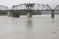
A view from upstream of the Corman Railroad bridge
Only 34 feet left until the water reaches the record set in 1936 where the water reached the bottom of the bridge steelwork.
The rising water has crossed the road at the fairgrounds park forcing its closure.
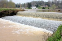
The spillway for Swan Lake
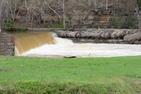
Heavy water flows over the old mill dam at Ringgold Creek.
The Swan Lake golf course sign peeks out a lake created by the water overflowing from Swan Lake and the Dunbar cave system.
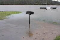
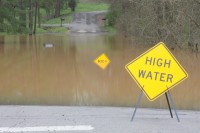
A high water sign overlooks another submerged warning sign placed when the water was a bit lower, a submerged mailbox peeks out of the water behind it.
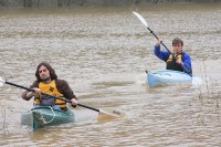
Beehives along West Creek Road overlook the Red River which has overflowed it’s banks
With the Red River having overflowed it’s banks it was the perfect opportunity for a little backyard kayaking. Randall Boen (front) and Ted Kitterman (behind) make it look easy. At the same time they are practicing safe watersports by wearing their floation devices.
With the Red River having overflowed it’s banks it was the perfect opportunity for a little backyard kayaking. Randall Boen (front) and Ted Kitterman (behind) make it look easy. At the same time they are practicing safe watersports by wearing their floation devices.
Bill Larson is is politically and socially active in the community. Bill is a member of the Friends of Dunbar Cave.
You can reach him via telephone at 931-249-0043 or via the email address below.